
Seminole County ZIP Coverage
Seminole County includes seven cities plus Geneva, Chuluota, Heathrow, Goldenrod, and other postal or unincorporated communities. The table is a working countywide inventory drawn from the county's ZIP and PO-box layer research. It groups related codes because the crawler did not expose official station names or every polygon attribute. Verify a specific street with USPS and the county GIS before treating any row as final.
| ZIP | Principal areas | Postal family | Boundary note |
|---|---|---|---|
| 32701, 32714 | Altamonte Springs | Street delivery | City and postal coverage differ |
| 32715, 32716 | Altamonte Springs | PO-box or unique candidates | Verify with USPS |
| 32707, 32730 | Casselberry | Street delivery | Crosses jurisdictions |
| 32718 | Casselberry | PO-box candidate | Verify the address |
| 32732 | Geneva | PO-box/rural | Rural postal geography |
| 32746, 32795 | Lake Mary | Street and PO-box families | City plus postal area |
| 32750, 32779, 32752, 32791 | Longwood/Wekiva | Street and PO-box families | 32779 reaches west/northwest |
| 32762, 32765, 32766 | Oviedo/Chuluota/east rural | Mixed | 32766 has broad rural reach |
| 32771, 32772, 32773 | Sanford | Street and PO-box families | City and unincorporated areas |
| 32708, 32719 | Winter Springs | Street and PO-box families | Verify PO-box status |
| 32703, 32712, 32751, 32817, 32820, 32825, 32826 | County-edge postal areas | Edge crossings | Confirm every address |
This ZIP code directory does not label an address incorporated or unincorporated. It records a postal association. The county's 2024 estimate was 494,605 people, nearly 72,000 more than the 2010 count, but growth alone does not show where a particular postal boundary falls.
Sanford ZIP Code Family
Sanford illustrates why one city name is not enough. ZIPs 32771 and 32773 cover city and unincorporated postal areas, while 32772 is identified as a PO-box code. A record with “Sanford” in its mailing address may therefore sit outside Sanford's incorporated boundary or involve a box instead of a physical site. For property work, compare the parcel's situs address, which is the assessed location, with its owner mailing address. Those fields can point to different ZIPs without any error.
When a family-history source says Sanford, search the wider place context too. The county seat grew from Mellonville and later river, rail, citrus, and celery development. Modern ZIP geography cannot be used to assign an old document to a present postal code. Current address verification and historical place research answer different questions.
Seminole ZIP Boundary Oddities
Oviedo's postal family includes 32762, 32765, and 32766. The research flags 32762 as a PO-box code and 32766 as a broad rural postal area tied to Oviedo, Chuluota, and eastern Seminole County. Longwood and Wekiva use 32750 and 32779, with 32779 extending into western and northwestern postal neighborhoods. Longwood also has 32752 and 32791 as PO-box candidates. These labels describe delivery patterns. They do not settle city jurisdiction, zoning, or the government office that holds a record.
Altamonte Springs, Casselberry, Lake Mary, and Winter Springs show the same mismatch in different forms. An address can carry a familiar city in the mailing line while county GIS places it elsewhere for municipal or taxing purposes. Profile 3's geography interest is especially useful here: mailing city, incorporated jurisdiction, and historical community often disagree in Seminole County.
Verify Seminole County ZIP Codes
The official USPS ZIP Code Lookup is the final postal check for a current address. It can look up a ZIP by street address or return cities associated with a ZIP. Enter the full street line, city, and state when known. A ZIP-only result is broader and should not be treated as proof that a person lives at a certain property.
The USPS interface shown below is the successful image assigned to this ZIP code directory.
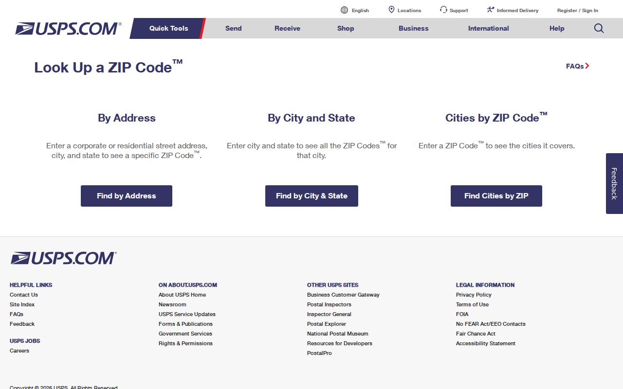
Copy the standardized result exactly, then compare it with the county layer rather than guessing from the mailing city.
| Lookup field | Use |
|---|---|
| Street address | Best route to a current ZIP and standardized mailing line. |
| City and state | Supports address validation but may not state municipal jurisdiction. |
| ZIP | Returns associated postal city names, not a resident list. |
Note: USPS verifies postal delivery; county GIS supplies the local government and boundary context needed for public-record searches.
Map Seminole ZIP Layers
Seminole County publishes separate ZipCodes and ZipCodesPOBox GIS layers. It also publishes city limits and ordinances, address points, streets, parcels, lot lines, subdivisions, HOA or condominium associations, election and school districts, and other boundary data. Overlaying ZIP polygons with CityLimits is the right way to see where postal and municipal geography diverge. GIS staff can be reached at 407-665-1105 or gis_staff@seminolecountyfl.gov.
The ZIP code directory uses those layers as boundary evidence, but the web research could not expose a row-by-row official export. That is why the coverage table clearly marks PO-box candidates and edge areas for verification. County data can be downloaded rather than copied from a commercial list.
Search Seminole Residents by ZIP
No single county portal publishes a public resident list filtered by ZIP. The county GIS maps ZIP polygons, the FDLE registry accepts ZIP as one field for its narrow statutory purpose, and a lawfully obtained voter extract can be filtered after delivery. The local voter page is not a public ZIP browser. It authenticates one voter with first name, last name, and date of birth. Broader voter data must come through the proper request channel, with protected voters and confidential fields removed.
- Verify the current ZIP from a complete address through USPS.
- Overlay that ZIP with county city-limit and parcel layers.
- Choose a record source that lawfully supports the research purpose and ZIP field.
- Filter the result by ZIP, then compare names against the underlying record.
- Narrow to a street or parcel only when the source provides address-level evidence.
The Seminole County Property Appraiser accepts owner, parcel, street name, address, facility name, or subdivision, but it does not advertise a ZIP filter. Once the search narrows to a street, use the Seminole County street directory workflow for parcel and deed work.
Seminole ZIP Voter Extracts
Florida public voter data may include name, address, date of birth, party, phone, and email, subject to exemptions. It excludes confidential identification fields, and protected voters may be absent. Voting history lists elections in which a person participated, never vote choices. The state monthly extract covers active and inactive records through the prior month. A requester provides contact details and a mailing address; delivery is by disk through mail or pickup, not email, and possible charges may apply.
Seminole County Elections moved public-record requests to NextRequest in July 2025. Requests are handled in received and paid order, and election workload affects timing. State extracts come from the Florida voter extract process. Specify the desired format and filters. Do not describe either route as a live public resident lookup.
ZIP Boundaries and Seminole Limits
A ZIP is a mail-delivery area, not a city, voting district, tax district, or proof of residence. ZIP+4 narrows a delivery segment within the base code. A PO-box ZIP serves post office boxes rather than ordinary street delivery. A unique ZIP may serve one large organization. A carrier route groups addresses for mail delivery and can cross boundaries meaningful to local records.
- ZIP
- A five-digit postal delivery area.
- ZIP+4
- The base ZIP plus four digits for a smaller delivery segment.
- PO-box ZIP
- A code used chiefly or solely for post office boxes.
- Unique ZIP
- A code assigned to one high-volume recipient.
- Carrier route
- A postal delivery path, not a government boundary.
Seminole County records add more address types. Situs means the physical location assessed on a parcel. The owner mailing address is where tax mail goes and may be outside the county. A legal description identifies land by lot, block, plat, or other recorded terms and can survive a street rename. Keep those fields separate when a ZIP code directory result seems inconsistent.
Keep the date of each lookup in the notes. Postal assignments, street names, and municipal borders can change at different times, while an old deed keeps the legal description used when it was recorded. A current USPS result is best for present mail delivery. County GIS supplies today's boundary context. The recorded plat and legal description provide the bridge to old land records. Using each source for its own purpose prevents a shared postal city from being mistaken for proof of city residence.